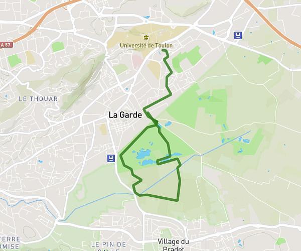
This running route covers 3.869mi starting from Solliès-Pont, Var. The run is a loop trail and returns to the trailhead. This run is rated as easy, expect about 46m42s to complete it. The route has an elevation gain of 374ft and an elevation loss of 407ft.
chapelle st Christine
Route details
4.97mph
Speed
534 kcal
Calories burned
Loop trail
Route type
253ft
Min altitude
659ft
Max altitude
Route profile
374ft
Elevation gain
407ft
Elevation loss
253ft
Min altitude
659ft
Max altitude
How to get there
Trailhead: 765 Avenue De L'arlésienne, 83210 Solliès-Pont, France
GPS coordinates of the trailhead: 43.20186, 6.05105 / 43°12'6'' N, 6°3'3'' E