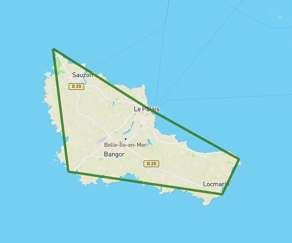
This running route covers 3.488mi starting from Le Palais, Morbihan. The run is a loop trail and returns to the trailhead. This run is rated as easy, expect about 1h to complete it. The route has an elevation gain of 16ft and an elevation loss of 16ft.
Maison
Route details
3.49mph
Speed
686 kcal
Calories burned
Loop trail
Route type
151ft
Min altitude
167ft
Max altitude
Route profile
16ft
Elevation gain
16ft
Elevation loss
151ft
Min altitude
167ft
Max altitude
How to get there
Trailhead: 155 Kerdenet, 56360 Le Palais, France
GPS coordinates of the trailhead: 47.33667, -3.17464 / 47°20'12'' N, 3°10'28'' W