MapPlanner
4.511mi
Distance
27m
Duration
10.02mph
Speed
+374ft
Elevation gain
-371ft
Elevation loss
Easy
Level

Figo 1

Route details

241 kcal
Calories burned
3.1%
Avg grade
Loop trail
Route type
85ft
Min altitude
207ft
Max altitude

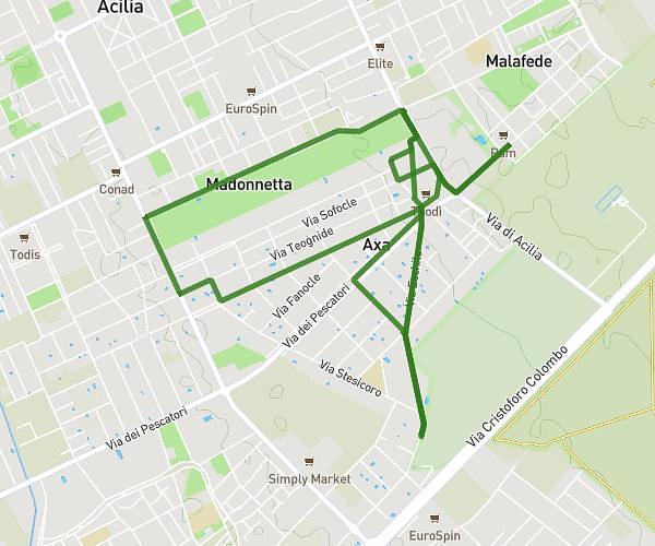
This cycling route covers 4.511mi starting from Roma, Rome. The ride is a loop trail and returns to the trailhead. This route is rated as easy, plan for about 27m to complete it. The route has an elevation gain of 374ft and an elevation loss of 371ft.

Route profile

374ft
Elevation gain
371ft
Elevation loss
85ft
Min altitude
207ft
Max altitude

How to get there

Trailhead: Via Eschilo 116, 00125 Roma Rome, Italy

GPS coordinates of the trailhead: 41.759196, 12.372276 / 41°45'33'' N, 12°22'20'' E

Caution: May Cross Private Property

This route may pass through or near private property. Always respect posted signs, obtain permission where required, and follow local trespassing laws. MapPlanner does not guarantee public access along any route.

Safety Notice

Trail and road conditions may change without notice due to weather, construction, or other factors. Always verify current conditions before heading out. You are responsible for your own safety — follow local signage, obey traffic laws, and use your best judgment on the trail.