MapPlanner
9.972mi
Distance
1h36m
Duration
6.21mph
Speed
+276ft
Elevation gain
-262ft
Elevation loss
Easy
Level

quimper

Route details

848 kcal
Calories burned
1.0%
Avg grade
Loop trail
Route type
10ft
Min altitude
285ft
Max altitude

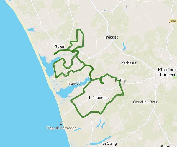
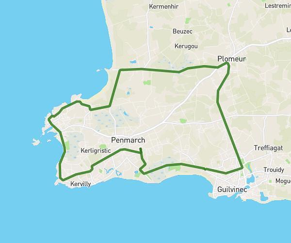
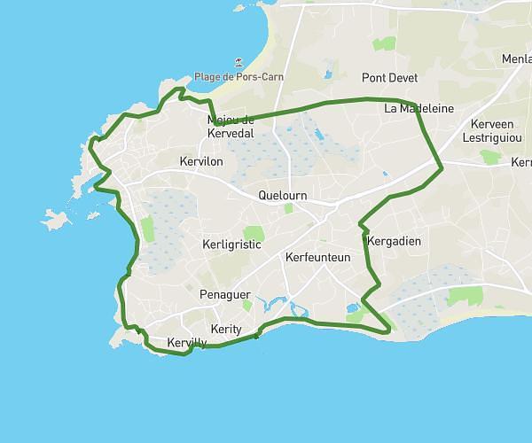
This cycling route covers 9.972mi starting from Quimper, Finistère. The ride is a loop trail and returns to the trailhead. This route is rated as easy, plan for about 1h36m to complete it. The route has an elevation gain of 276ft and an elevation loss of 262ft.

Route profile

276ft
Elevation gain
262ft
Elevation loss
10ft
Min altitude
285ft
Max altitude

How to get there

Trailhead: 61 Rue Du Président Kennedy, 29000 Quimper, France

GPS coordinates of the trailhead: 47.98499, -4.04391 / 47°59'5'' N, 4°2'38'' W

Caution: May Cross Private Property

This route may pass through or near private property. Always respect posted signs, obtain permission where required, and follow local trespassing laws. MapPlanner does not guarantee public access along any route.

Safety Notice

Trail and road conditions may change without notice due to weather, construction, or other factors. Always verify current conditions before heading out. You are responsible for your own safety — follow local signage, obey traffic laws, and use your best judgment on the trail.