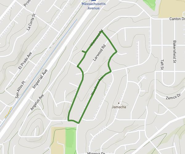
This walking route covers 1.044mi starting from San Diego, California. The walk is a loop trail and returns to the trailhead. This walk is rated as easy, plan for about 18m to complete it. The route has an elevation gain of 95ft and an elevation loss of 89ft.
Mile loop with hill (back surgery rehab)
Route details
17:15/mi
Pace
74 kcal
Calories burned
Loop trail
Route type
348ft
Min altitude
436ft
Max altitude
Route profile
95ft
Elevation gain
89ft
Elevation loss
348ft
Min altitude
436ft
Max altitude
How to get there
Trailhead: 1354 Watwood Road, San Diego, California 92114, United States
GPS coordinates of the trailhead: 32.71991, -117.04037 / 32°43'11'' N, 117°2'25'' W