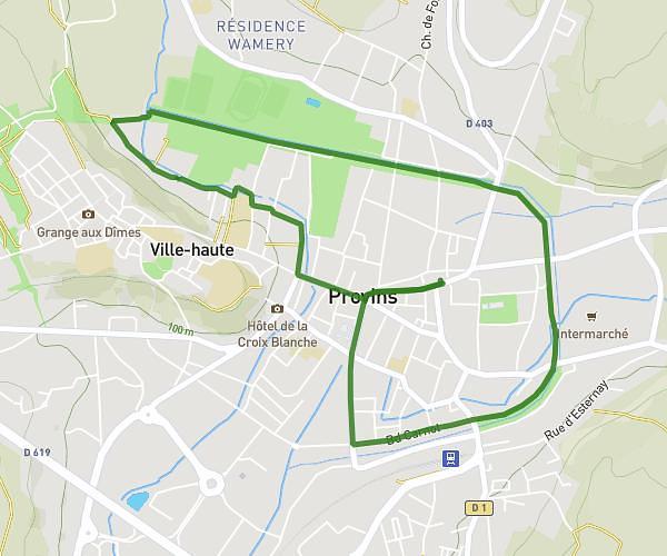
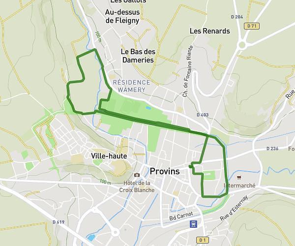
This running route covers 3.861mi starting from Provins, Seine-et-Marne. The run is a loop trail and returns to the trailhead. This run is rated as easy, expect about 41m to complete it. The route has an elevation gain of 292ft and an elevation loss of 289ft.
course des remparts
Route details
5.65mph
Speed
469 kcal
Calories burned
Loop trail
Route type
292ft
Min altitude
456ft
Max altitude
Route profile
292ft
Elevation gain
289ft
Elevation loss
292ft
Min altitude
456ft
Max altitude
How to get there
Trailhead: 35 Boulevard D'aligre, 77160 Provins, France
GPS coordinates of the trailhead: 48.564832, 3.294734 / 48°33'53'' N, 3°17'41'' E