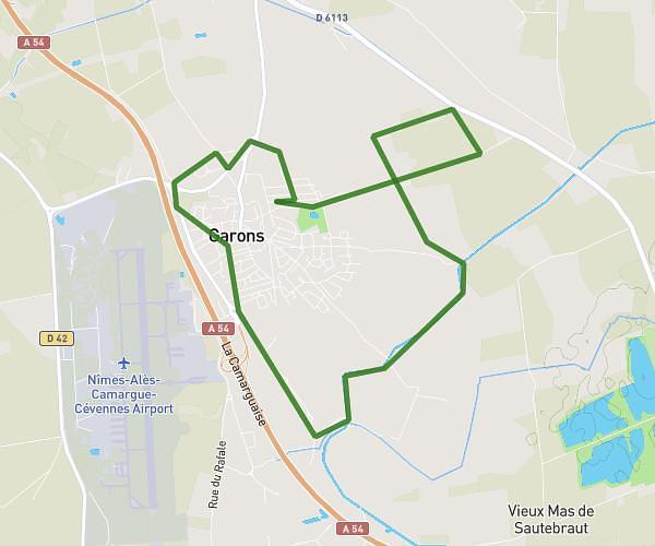
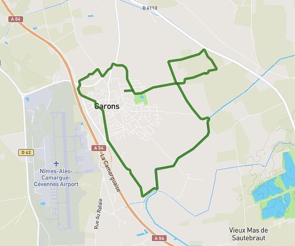
This running route covers 6.993mi starting from Nîmes, Gard. The run is a loop trail and returns to the trailhead. This run is rated as moderate, expect about 1h7m to complete it. The route has an elevation gain of 89ft and an elevation loss of 95ft.
Parcours plat
Route details
6.21mph
Speed
772 kcal
Calories burned
Loop trail
Route type
95ft
Min altitude
190ft
Max altitude
Route profile
89ft
Elevation gain
95ft
Elevation loss
95ft
Min altitude
190ft
Max altitude
How to get there
Trailhead: 5 Avenue Franklin Roosevelt, 30000 Nîmes, France
GPS coordinates of the trailhead: 43.83843, 4.34995 / 43°50'18'' N, 4°20'59'' E