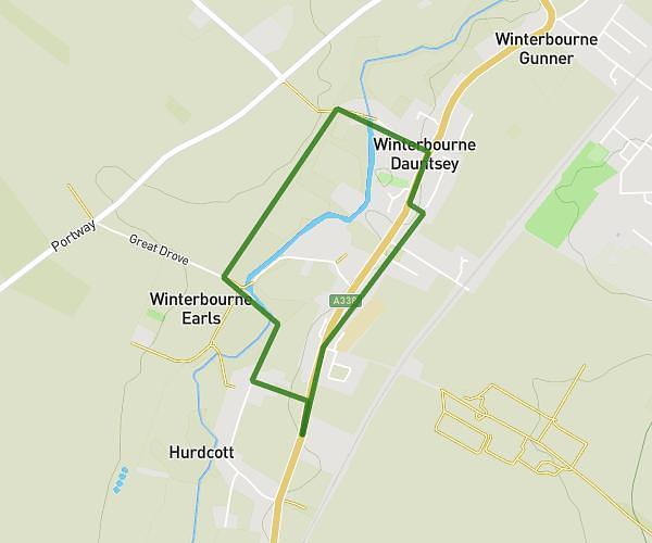
This walking route covers 3.982mi starting from Salisbury, England. The walk is a loop trail and returns to the trailhead. This walk is rated as moderate, plan for about 1h to complete it. The route has an elevation gain of 371ft and an elevation loss of 371ft.
Finsbury Ring
Route details
15:04/mi
Pace
245 kcal
Calories burned
Loop trail
Route type
197ft
Min altitude
456ft
Max altitude
Route profile
371ft
Elevation gain
371ft
Elevation loss
197ft
Min altitude
456ft
Max altitude
How to get there
Trailhead: A338, Winterbourne Earls, Salisbury, SP4 6HL, United Kingdom
GPS coordinates of the trailhead: 51.10395, -1.75595 / 51°6'14'' N, 1°45'21'' W