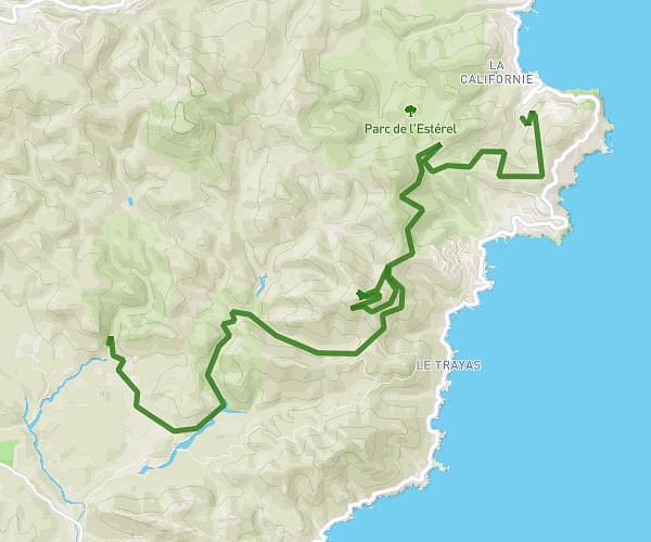
This cycling route covers 13.189mi starting from Grimaud, Var. The ride is a loop trail and returns to the trailhead. This route is rated as hard, plan for about 1h20m to complete it. The route has an elevation gain of 899ft and an elevation loss of 984ft.
plan de la tour
Route details
712 kcal
Calories burned
2.7%
Avg grade
Loop trail
Route type
144ft
Min altitude
712ft
Max altitude
Route profile
899ft
Elevation gain
984ft
Elevation loss
144ft
Min altitude
712ft
Max altitude
How to get there
Trailhead: 58 Domaine Le Cros D'entassi, 83310 Grimaud, France
GPS coordinates of the trailhead: 43.290718, 6.579406 / 43°17'26'' N, 6°34'45'' E