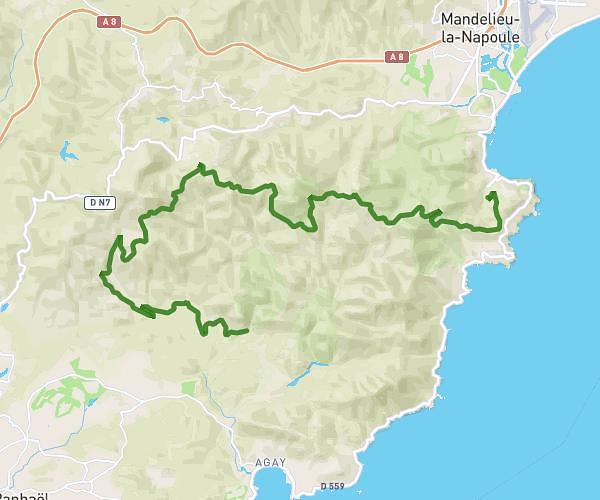
This cycling route covers 13.184mi starting from Saint-Raphaël, Var. The ride does not return to the trailhead and ends near 14 Rue Du Sanglier, 06590 Théoule-sur-Mer, France. This route is rated as strenuous, plan for about 1h20m to complete it. The route has an elevation gain of 2211ft and an elevation loss of 2165ft.
Tour des cols de l'Estérel Part.2
Route details
730 kcal
Calories burned
6.3%
Avg grade
Point to point
Route type
92ft
Min altitude
1552ft
Max altitude
Steep climb
Route profile
2211ft
Elevation gain
2165ft
Elevation loss
92ft
Min altitude
1552ft
Max altitude
How to get there
Trailhead: Pont Du Perthus, 83700 Saint-Raphaël, France
GPS coordinates of the trailhead: 43.469247, 6.855723 / 43°28'9'' N, 6°51'20'' E