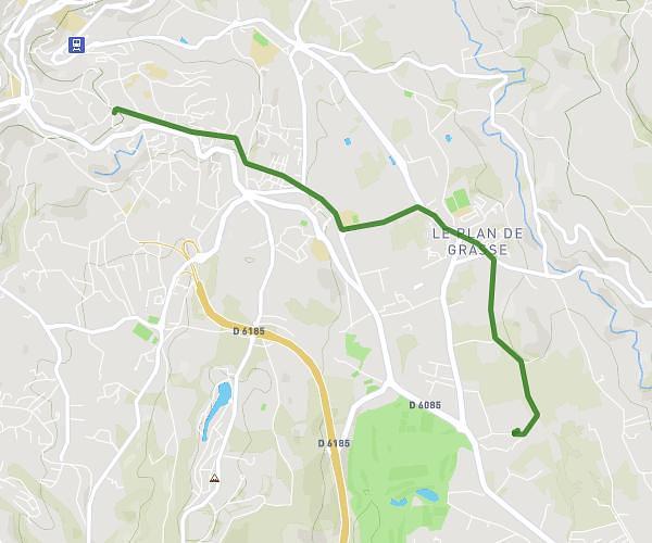
This cycling route covers 3.404mi starting from Grasse, Alpes-Maritimes. The ride does not return to the trailhead and ends near Avenue Sidi Brahim, 06130 Grasse. This route is rated as easy, plan for about 21m to complete it. The route has an elevation gain of 446ft and an elevation loss of 0ft.
retour EP
Route details
190 kcal
Calories burned
2.5%
Avg grade
Point to point
Route type
374ft
Min altitude
820ft
Max altitude
Route profile
446ft
Elevation gain
0ft
Elevation loss
374ft
Min altitude
820ft
Max altitude
How to get there
Trailhead: Chemin De Saint-Marc, 06130 Grasse
GPS coordinates of the trailhead: 43.63107, 6.96169 / 43°37'51'' N, 6°57'42'' E