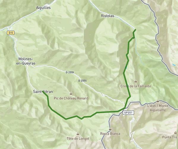
This hiking trail covers 1.043mi starting from Molines-en-Queyras, Hautes-Alpes. The hike does not return to the trailhead and ends near D 205, 05350 Molines-en-Queyras. This hike is rated as easy, plan for about 2h to complete it. The route has an elevation gain of 16ft and an elevation loss of 282ft.
TQ J3 b
Route details
0.52mph
Speed
844 kcal
Calories burned
5.4%
Avg grade
Point to point
Route type
6302ft
Min altitude
6568ft
Max altitude
Route profile
16ft
Elevation gain
282ft
Elevation loss
6302ft
Min altitude
6568ft
Max altitude
How to get there
Trailhead: Rue Du Col Agnel, 05350 Molines-en-Queyras
GPS coordinates of the trailhead: 44.72213, 6.88766 / 44°43'19'' N, 6°53'15'' E