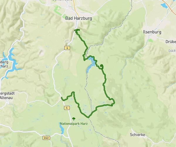
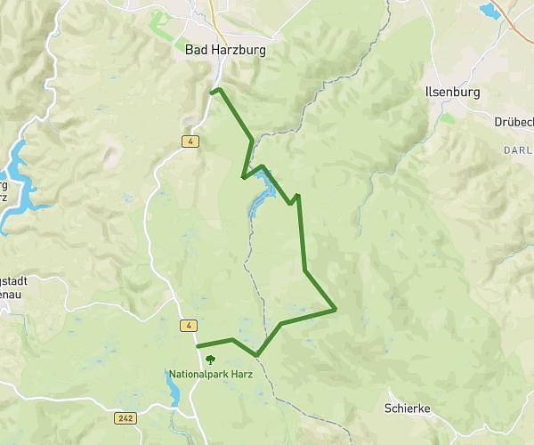
This hiking trail covers 7.342mi starting from Bad Harzburg, Lower Saxony. The hike is a loop trail and returns to the trailhead. This hike is rated as hard, plan for about 2h21m to complete it. The route has an elevation gain of 1529ft and an elevation loss of 1555ft.
TL_Freitag_12km
Route details
3.11mph
Speed
1058 kcal
Calories burned
8.0%
Avg grade
Loop trail
Route type
1040ft
Min altitude
1886ft
Max altitude
Steep climb
Route profile
1529ft
Elevation gain
1555ft
Elevation loss
1040ft
Min altitude
1886ft
Max altitude
How to get there
Trailhead: Nordhäuser Straße 3, 38667 Bad Harzburg, Germany
GPS coordinates of the trailhead: 51.868319, 10.559578 / 51°52'5'' N, 10°33'34'' E