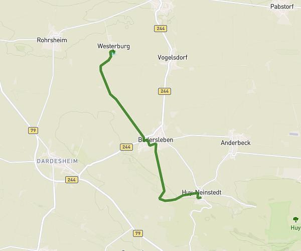
This hiking trail covers 5.735mi starting from Huy, Saxony-Anhalt. The hike does not return to the trailhead and ends near Westerburg 34, 38836 Huy, Germany. This hike is rated as easy, plan for about 27m to complete it. The route has an elevation gain of 285ft and an elevation loss of 512ft.
Strecke Walker Huy Neinstedt zur Westerburg
Route details
12.74mph
Speed
192 kcal
Calories burned
2.6%
Avg grade
Point to point
Route type
390ft
Min altitude
748ft
Max altitude
Route profile
285ft
Elevation gain
512ft
Elevation loss
390ft
Min altitude
748ft
Max altitude
How to get there
Trailhead: Lange Straße 8, 38836 Huy, Germany
GPS coordinates of the trailhead: 51.964272, 10.914704 / 51°57'51'' N, 10°54'52'' E