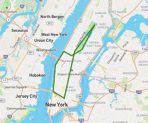
This cycling route covers 35.56mi starting from New York, New York. The ride is a loop trail and returns to the trailhead. This route is rated as hard, plan for about 5h30m to complete it. The route has an elevation gain of 125ft and an elevation loss of 213ft.
Home thru Manhattan type shi
Route details
2891 kcal
Calories burned
0.2%
Avg grade
Loop trail
Route type
16ft
Min altitude
131ft
Max altitude
Route profile
125ft
Elevation gain
213ft
Elevation loss
16ft
Min altitude
131ft
Max altitude
How to get there
Trailhead: 288 Van Buren Street, Brooklyn, New York 11221, United States
GPS coordinates of the trailhead: 40.69078, -73.93532 / 40°41'26'' N, 73°56'7'' W