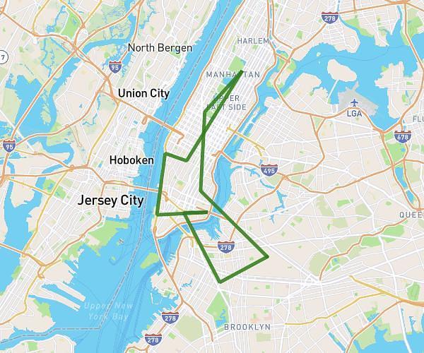
This cycling route covers 15.032mi starting from New York, New York. The ride is a loop trail and returns to the trailhead. This route is rated as strenuous, plan for about 1h40m to complete it. The route has an elevation gain of 2162ft and an elevation loss of 2162ft.
Bike ride
Route details
909 kcal
Calories burned
5.4%
Avg grade
Loop trail
Route type
-13ft
Min altitude
269ft
Max altitude
Steep climb
Route profile
2162ft
Elevation gain
2162ft
Elevation loss
-13ft
Min altitude
269ft
Max altitude
How to get there
Trailhead: 123 Elizabeth Street, New York, New York 10013, United States
GPS coordinates of the trailhead: 40.719397, -73.995561 / 40°43'9'' N, 73°59'44'' W