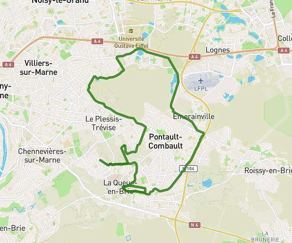
This running route covers 4.726mi starting from Saint-Maur-des-Fossés, Val-de-Marne. The run is a loop trail and returns to the trailhead. This run is rated as easy, expect about 51m to complete it. The route has an elevation gain of 164ft and an elevation loss of 164ft.
5km leonard
Route details
5.56mph
Speed
583 kcal
Calories burned
Loop trail
Route type
102ft
Min altitude
135ft
Max altitude
Route profile
164ft
Elevation gain
164ft
Elevation loss
102ft
Min altitude
135ft
Max altitude
How to get there
Trailhead: 3 Avenue Du Lieutenant Chauré, 94100 Saint-Maur-des-Fossés, France
GPS coordinates of the trailhead: 48.79941, 2.49814 / 48°47'57'' N, 2°29'53'' E