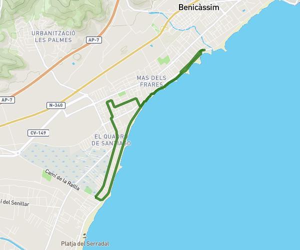
This running route covers 6.219mi starting from Castelló de la Plana, Castellón. The run is a loop trail and returns to the trailhead. This run is rated as moderate, expect about 1h to complete it. The route has an elevation gain of 266ft and an elevation loss of 266ft.
Entrenamiento Behobia
Route details
6.22mph
Speed
686 kcal
Calories burned
Loop trail
Route type
154ft
Min altitude
374ft
Max altitude
Route profile
266ft
Elevation gain
266ft
Elevation loss
154ft
Min altitude
374ft
Max altitude
How to get there
Trailhead: Carrer D'honori Garcia I Garcia / Calle Honori Garcia I Garcia 41, 12006 Castelló de la Plana, Castellón, Spain
GPS coordinates of the trailhead: 39.99084, -0.06568 / 39°59'27'' N, 0°3'56'' W