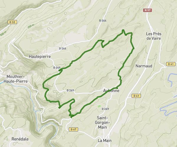
This running route covers 6.488mi starting from Aubonne, Doubs. The run is a loop trail and returns to the trailhead. This run is rated as moderate, expect about 1h30m to complete it. The route has an elevation gain of 820ft and an elevation loss of 646ft.
creuse loue pontet vouille aiguillon
Route details
4.32mph
Speed
1029 kcal
Calories burned
Loop trail
Route type
1463ft
Min altitude
2283ft
Max altitude
Route profile
820ft
Elevation gain
646ft
Elevation loss
1463ft
Min altitude
2283ft
Max altitude
How to get there
Trailhead: Route Des Gorges De Nouailles, 25920 Aubonne
GPS coordinates of the trailhead: 47.02444, 6.29985 / 47°1'27'' N, 6°17'59'' E