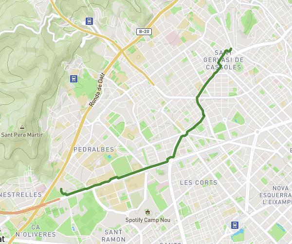
This walking route covers 2.234mi starting from Barcelona, Barcelona. The walk does not return to the trailhead and ends near Carrer De Coll I Alentorn, 08035 Barcelona. This walk is rated as easy, plan for about 1h29m to complete it. The route has an elevation gain of 413ft and an elevation loss of 489ft.
Dana
Route details
24:08/mi
Pace
363 kcal
Calories burned
Point to point
Route type
495ft
Min altitude
715ft
Max altitude
Route profile
413ft
Elevation gain
489ft
Elevation loss
495ft
Min altitude
715ft
Max altitude
How to get there
Trailhead: Carrer De Fastenrath, 08035 Barcelona
GPS coordinates of the trailhead: 41.42307, 2.14906 / 41°25'23'' N, 2°8'56'' E