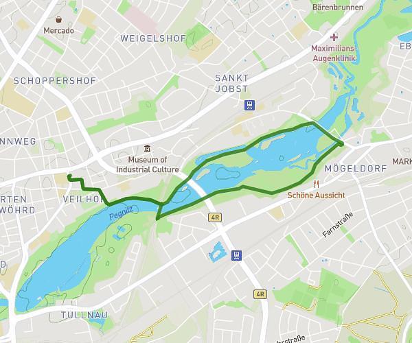
This running route covers 4.292mi starting from Nürnberg, Bavaria. The run is a loop trail and returns to the trailhead. This run is rated as easy, expect about 46m2s to complete it. The route has an elevation gain of 331ft and an elevation loss of 328ft.
Um den See
Route details
5.59mph
Speed
526 kcal
Calories burned
Loop trail
Route type
974ft
Min altitude
1040ft
Max altitude
Route profile
331ft
Elevation gain
328ft
Elevation loss
974ft
Min altitude
1040ft
Max altitude
How to get there
Trailhead: Bartholomäusstraße 68, 90489 Nürnberg, Germany
GPS coordinates of the trailhead: 49.459435, 11.103013 / 49°27'33'' N, 11°6'10'' E