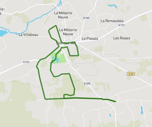
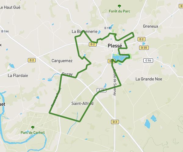
This hiking trail covers 5.719mi starting from Plessé, Loire-Atlantique. The hike is a loop trail and returns to the trailhead. This hike is rated as easy, plan for about 2h18m to complete it. The route has an elevation gain of 354ft and an elevation loss of 361ft.
9,204km
Route details
2.49mph
Speed
985 kcal
Calories burned
2.4%
Avg grade
Loop trail
Route type
26ft
Min altitude
131ft
Max altitude
Route profile
354ft
Elevation gain
361ft
Elevation loss
26ft
Min altitude
131ft
Max altitude
How to get there
Trailhead: Rue De Malagué, 44630 Plessé
GPS coordinates of the trailhead: 47.5459, -1.88597 / 47°32'45'' N, 1°53'9'' W