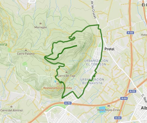
This hiking trail covers 3.363mi starting from Albolote, Granada. The hike is a loop trail and returns to the trailhead. This hike is rated as easy, plan for about 1h to complete it. The route has an elevation gain of 174ft and an elevation loss of 177ft.
Camino de las Cruces
Route details
3.36mph
Speed
427 kcal
Calories burned
2.0%
Avg grade
Loop trail
Route type
2119ft
Min altitude
2192ft
Max altitude
Route profile
174ft
Elevation gain
177ft
Elevation loss
2119ft
Min altitude
2192ft
Max altitude
How to get there
Trailhead: Calle Alcazaba 7, 18220 Albolote, Granada, Spain
GPS coordinates of the trailhead: 37.238743, -3.674341 / 37°14'19'' N, 3°40'27'' W