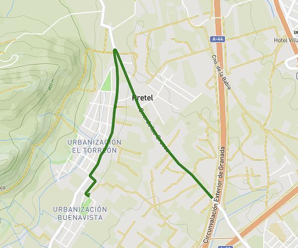
This hiking trail covers 6.251mi starting from Albolote, Granada. The hike is a loop trail and returns to the trailhead. This hike is rated as hard, plan for about 2h4s to complete it. The route has an elevation gain of 1109ft and an elevation loss of 1109ft.
El Torreón
Route details
3.13mph
Speed
888 kcal
Calories burned
6.7%
Avg grade
Loop trail
Route type
2133ft
Min altitude
2864ft
Max altitude
Route profile
1109ft
Elevation gain
1109ft
Elevation loss
2133ft
Min altitude
2864ft
Max altitude
How to get there
Trailhead: Calle Alcazaba 9, 18220 Albolote, Granada, Spain
GPS coordinates of the trailhead: 37.238752, -3.67425 / 37°14'19'' N, 3°40'27'' W