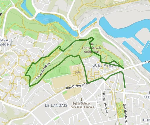
This running route covers 3.468mi starting from Plouzané, Finistère. The run is a loop trail and returns to the trailhead. This run is rated as easy, expect about 40m to complete it. The route has an elevation gain of 203ft and an elevation loss of 210ft.
entraînement 05/05
Route details
5.2mph
Speed
457 kcal
Calories burned
Loop trail
Route type
223ft
Min altitude
315ft
Max altitude
Route profile
203ft
Elevation gain
210ft
Elevation loss
223ft
Min altitude
315ft
Max altitude
How to get there
Trailhead: Rue Louis Le Pelletier, 29280 Plouzané
GPS coordinates of the trailhead: 48.38612, -4.59922 / 48°23'10'' N, 4°35'57'' W