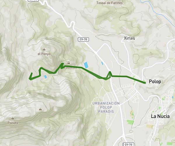
This hiking trail covers 4.202mi starting from La Vall de Laguar, Alicante. The hike is a loop trail and returns to the trailhead. This hike is rated as hard, plan for about 2h15m to complete it. The route has an elevation gain of 1066ft and an elevation loss of 1066ft.
fontilles
Route details
1.86mph
Speed
1022 kcal
Calories burned
9.6%
Avg grade
Loop trail
Route type
840ft
Min altitude
1437ft
Max altitude
Steep climb
Route profile
1066ft
Elevation gain
1066ft
Elevation loss
840ft
Min altitude
1437ft
Max altitude
How to get there
Trailhead: Carrer Sant Joan 50, 03791 La Vall de Laguar, Alicante, Spain
GPS coordinates of the trailhead: 38.776402, -0.108976 / 38°46'35'' N, 0°6'32'' W