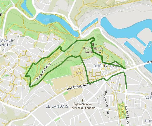
This running route covers 5.998mi starting from Brest, Finistère. The run does not return to the trailhead and ends near Rue Du Bouguen, 29200 Brest. This run is rated as moderate, expect about 1h36m to complete it. The route has an elevation gain of 121ft and an elevation loss of 180ft.
10km lyaz
Route details
3.73mph
Speed
1104 kcal
Calories burned
Point to point
Route type
26ft
Min altitude
154ft
Max altitude
Route profile
121ft
Elevation gain
180ft
Elevation loss
26ft
Min altitude
154ft
Max altitude
How to get there
Trailhead: Rue Désiré Lucas, 29200 Brest
GPS coordinates of the trailhead: 48.40982, -4.49317 / 48°24'35'' N, 4°29'35'' W