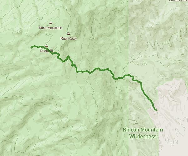
This hiking trail covers 14.082mi starting from Tucson, Arizona. The hike does not return to the trailhead and ends near 85602 Benson. This hike is rated as strenuous, plan for about 12h53m to complete it. The route has an elevation gain of 6335ft and an elevation loss of 1486ft.
Saguaro to Manning Camp
Route details
1.09mph
Speed
6179 kcal
Calories burned
10.5%
Avg grade
Point to point
Route type
3094ft
Min altitude
8176ft
Max altitude
Steep climb
Route profile
6335ft
Elevation gain
1486ft
Elevation loss
3094ft
Min altitude
8176ft
Max altitude
How to get there
Trailhead: Cactus Forest Drive, 85730 Tucson
GPS coordinates of the trailhead: 32.16561, -110.72368 / 32°9'56'' N, 110°43'25'' W