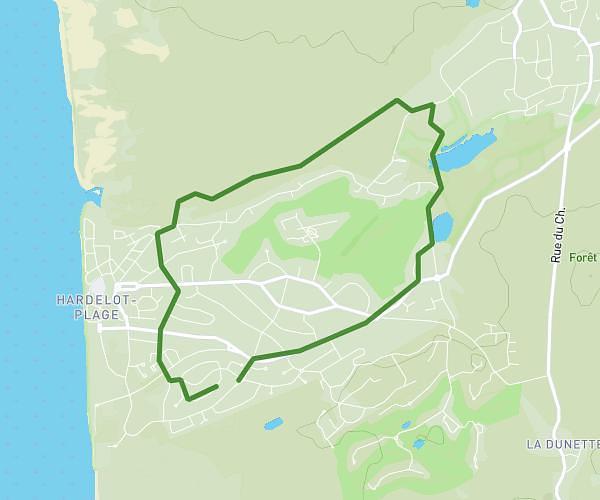
This running route covers 3.147mi starting from Merlimont, Pas-de-Calais. The run is a loop trail and returns to the trailhead. This run is rated as easy, expect about 32m10s to complete it. The route has an elevation gain of 213ft and an elevation loss of 213ft.
Merlimont parcours sportif
Route details
5.87mph
Speed
368 kcal
Calories burned
Loop trail
Route type
20ft
Min altitude
56ft
Max altitude
Route profile
213ft
Elevation gain
213ft
Elevation loss
20ft
Min altitude
56ft
Max altitude
How to get there
Trailhead: 1110 Rue Joseph Daubrège, 62155 Merlimont, France
GPS coordinates of the trailhead: 50.46547, 1.61476 / 50°27'55'' N, 1°36'53'' E