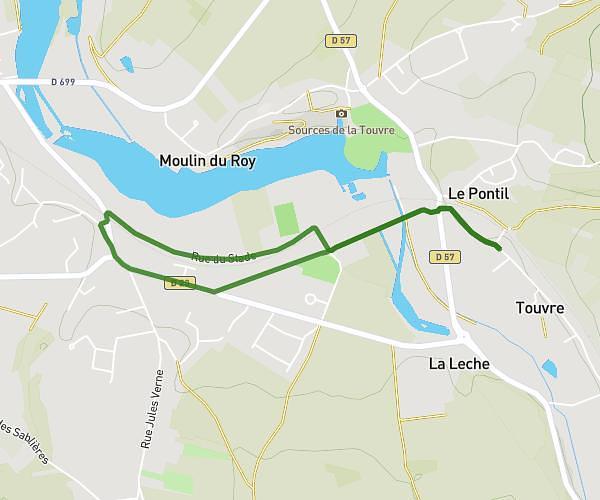
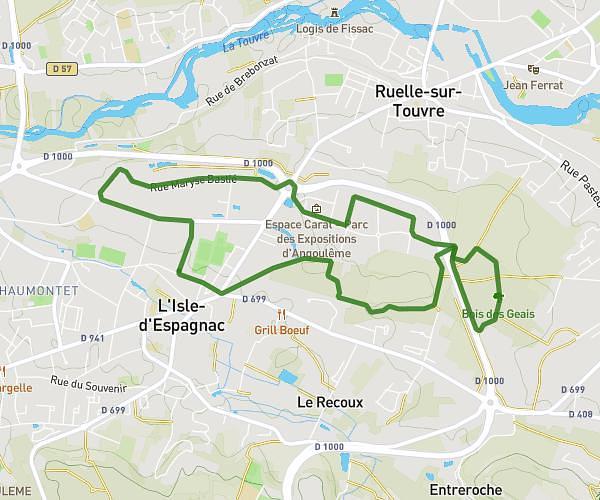
This running route covers 4.863mi starting from L'Isle-d'Espagnac, Charente. The run is a loop trail and returns to the trailhead. This run is rated as easy, expect about 45m to complete it. The route has an elevation gain of 384ft and an elevation loss of 394ft.
parcours l'isle d'espagnac 4
Route details
6.49mph
Speed
515 kcal
Calories burned
Loop trail
Route type
154ft
Min altitude
374ft
Max altitude
Route profile
384ft
Elevation gain
394ft
Elevation loss
154ft
Min altitude
374ft
Max altitude
How to get there
Trailhead: Avenue De La Quintinie, 16340 L'Isle-d'Espagnac, France
GPS coordinates of the trailhead: 45.667371, 0.200296 / 45°40'2'' N, 0°12'1'' E