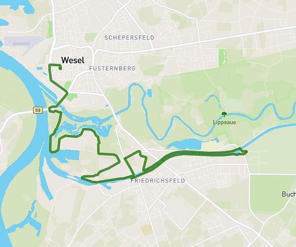
This cycling route covers 5.469mi starting from Borken, North Rhine-Westphalia. The ride does not return to the trailhead and ends near Eggenkamp 16a, 46325 Borken, Germany. This route is rated as easy, plan for about 33m to complete it. The route has an elevation gain of 230ft and an elevation loss of 203ft.
Frauentour 26
Route details
292 kcal
Calories burned
1.5%
Avg grade
Point to point
Route type
128ft
Min altitude
184ft
Max altitude
Route profile
230ft
Elevation gain
203ft
Elevation loss
128ft
Min altitude
184ft
Max altitude
How to get there
Trailhead: Am Kaninchenberg 11a, 46325 Borken, Germany
GPS coordinates of the trailhead: 51.833155, 6.793544 / 51°49'59'' N, 6°47'36'' E