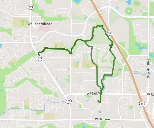
This cycling route covers 10.053mi starting from Lakewood, Colorado. The ride does not return to the trailhead and ends near 10210 West Alameda Avenue, Lakewood, Colorado 80226, United States. This route is rated as moderate, plan for about 1h1m to complete it. The route has an elevation gain of 614ft and an elevation loss of 650ft.
home to crown hill
Route details
542 kcal
Calories burned
2.4%
Avg grade
Point to point
Route type
5486ft
Min altitude
5673ft
Max altitude
Route profile
614ft
Elevation gain
650ft
Elevation loss
5486ft
Min altitude
5673ft
Max altitude
How to get there
Trailhead: 395 South Lewis Street, Lakewood, Colorado 80226, United States
GPS coordinates of the trailhead: 39.709276, -105.113423 / 39°42'33'' N, 105°6'48'' W