MapPlanner
7.191mi
Distance
1h1s
Duration
7.19mph
Speed
+315ft
Elevation gain
-315ft
Elevation loss
Easy
Level

First ride

Route details

531 kcal
Calories burned
1.7%
Avg grade
Loop trail
Route type
5302ft
Min altitude
5472ft
Max altitude

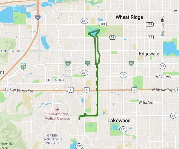
This cycling route covers 7.191mi starting from Westminster, Colorado. The ride is a loop trail and returns to the trailhead. This route is rated as easy, plan for about 1h1s to complete it. The route has an elevation gain of 315ft and an elevation loss of 315ft.

Route profile

315ft
Elevation gain
315ft
Elevation loss
5302ft
Min altitude
5472ft
Max altitude

How to get there

Trailhead: West 91st Court, 80021 Westminster

GPS coordinates of the trailhead: 39.86179, -105.0713 / 39°51'42'' N, 105°4'16'' W

Caution: May Cross Private Property

This route may pass through or near private property. Always respect posted signs, obtain permission where required, and follow local trespassing laws. MapPlanner does not guarantee public access along any route.

Safety Notice

Trail and road conditions may change without notice due to weather, construction, or other factors. Always verify current conditions before heading out. You are responsible for your own safety — follow local signage, obey traffic laws, and use your best judgment on the trail.