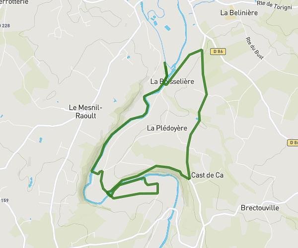
This running route covers 7.115mi starting from Sainte-Suzanne-sur-Vire, Manche. The run does not return to the trailhead and ends near 14 Rue Du Creuset, 50000 Saint-Lô, France. This run is rated as moderate, expect about 1h26m to complete it. The route has an elevation gain of 7ft and an elevation loss of 49ft.
parcours 11.400 km
Route details
4.96mph
Speed
983 kcal
Calories burned
Point to point
Route type
46ft
Min altitude
95ft
Max altitude
Route profile
7ft
Elevation gain
49ft
Elevation loss
46ft
Min altitude
95ft
Max altitude
How to get there
Trailhead: 7 Rue Des Jardins, 50750 Sainte-Suzanne-sur-Vire, France
GPS coordinates of the trailhead: 49.065268, -1.048082 / 49°3'54'' N, 1°2'53'' W