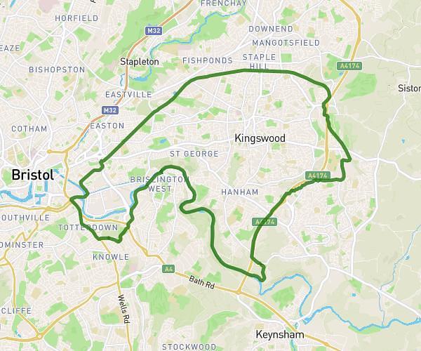
This cycling route covers 16.567mi starting from Bristol, England. The ride is a loop trail and returns to the trailhead. This route is rated as moderate, plan for about 5h19m to complete it. The route has an elevation gain of 331ft and an elevation loss of 443ft.
Ashton court to Pill and towpath home
Route details
2814 kcal
Calories burned
0.9%
Avg grade
Loop trail
Route type
26ft
Min altitude
305ft
Max altitude
Route profile
331ft
Elevation gain
443ft
Elevation loss
26ft
Min altitude
305ft
Max altitude
How to get there
Trailhead: 195 Wells Road, Bristol, BS4 2DB, United Kingdom
GPS coordinates of the trailhead: 51.43936, -2.57308 / 51°26'21'' N, 2°34'23'' W