MapPlanner
8.486mi
Distance
40m
Duration
12.73mph
Speed
+190ft
Elevation gain
-157ft
Elevation loss
Easy
Level

Earthcott loop

Route details

352 kcal
Calories burned
0.8%
Avg grade
Loop trail
Route type
177ft
Min altitude
361ft
Max altitude

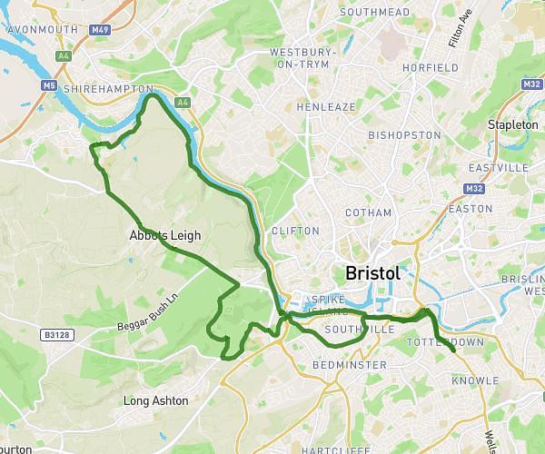
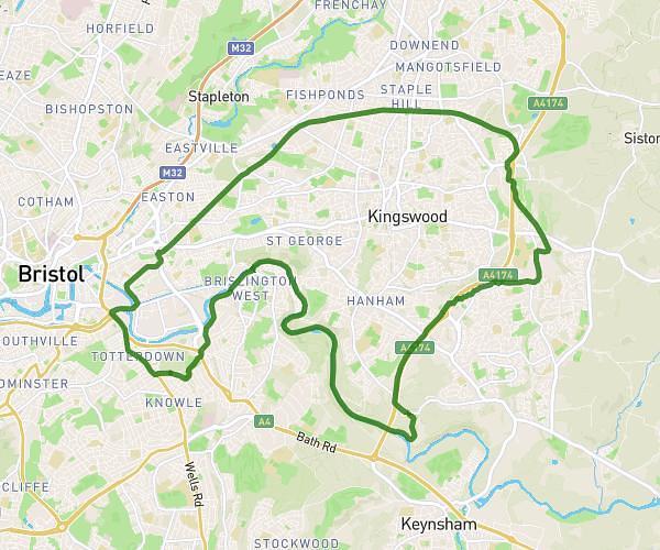
This cycling route covers 8.486mi starting from Bristol, England. The ride is a loop trail and returns to the trailhead. This route is rated as easy, plan for about 40m to complete it. The route has an elevation gain of 190ft and an elevation loss of 157ft.

Description of the route by the creator

Easy to moderate

Route profile

190ft
Elevation gain
157ft
Elevation loss
177ft
Min altitude
361ft
Max altitude

How to get there

Trailhead: 4 The Street, Alveston, Bristol, BS35 3SX, United Kingdom

GPS coordinates of the trailhead: 51.59018, -2.52584 / 51°35'24'' N, 2°31'33'' W

Caution: May Cross Private Property

This route may pass through or near private property. Always respect posted signs, obtain permission where required, and follow local trespassing laws. MapPlanner does not guarantee public access along any route.

Safety Notice

Trail and road conditions may change without notice due to weather, construction, or other factors. Always verify current conditions before heading out. You are responsible for your own safety — follow local signage, obey traffic laws, and use your best judgment on the trail.