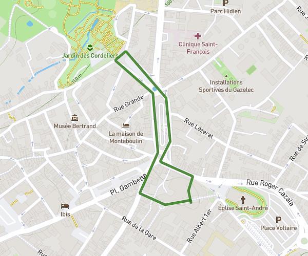
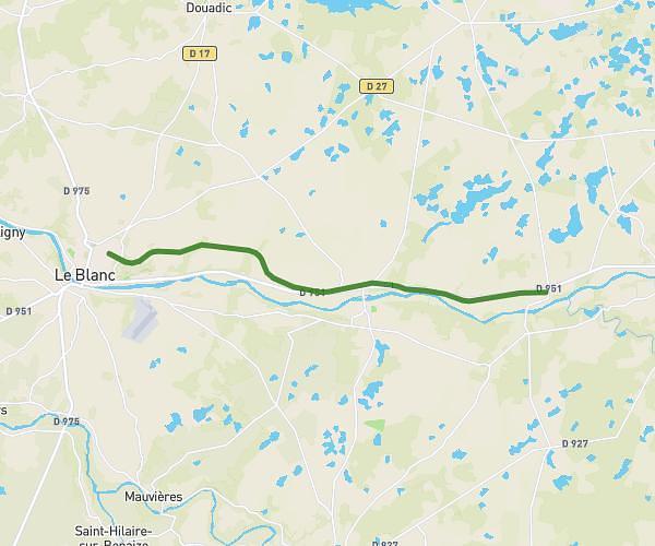
This running route covers 2.812mi starting from Argenton-sur-Creuse, Indre. The run does not return to the trailhead and ends near 14 Place De La République, 36200 Argenton-sur-Creuse, France. This run is rated as easy, expect about 30m to complete it. The route has an elevation gain of 154ft and an elevation loss of 157ft.
Parcours argenton c'est vous
Route details
5.62mph
Speed
343 kcal
Calories burned
Point to point
Route type
331ft
Min altitude
489ft
Max altitude
Route profile
154ft
Elevation gain
157ft
Elevation loss
331ft
Min altitude
489ft
Max altitude
How to get there
Trailhead: 5 Rue Du Champ De Foire, 36200 Argenton-sur-Creuse, France
GPS coordinates of the trailhead: 46.585577, 1.522607 / 46°35'8'' N, 1°31'21'' E