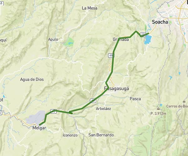
This cycling route covers 2.161mi starting from San Antonio del Tequendama, Cundinamarca. The ride does not return to the trailhead and ends near Soacha, Cundinamarca, 250057, Colombia. This route is rated as hard, plan for about 1h34s to complete it. The route has an elevation gain of 1726ft and an elevation loss of 446ft.
Chicaque
Route details
637 kcal
Calories burned
19.0%
Avg grade
Point to point
Route type
6988ft
Min altitude
8504ft
Max altitude
Steep climb
Route profile
1726ft
Elevation gain
446ft
Elevation loss
6988ft
Min altitude
8504ft
Max altitude
How to get there
Trailhead: San Antonio del Tequendama, Cundinamarca, 252627, Colombia
GPS coordinates of the trailhead: 4.614657, -74.311163 / 4°36'52'' N, 74°18'40'' W