MapPlanner
21.576mi
Distance
2h10m
Duration
9.96mph
Speed
+935ft
Elevation gain
-935ft
Elevation loss
Hard
Level

justine

Route details

1150 kcal
Calories burned
1.6%
Avg grade
Loop trail
Route type
36ft
Min altitude
226ft
Max altitude

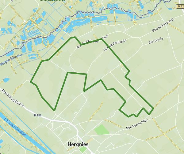
This cycling route covers 21.576mi starting from Rumes, Hainaut. The ride is a loop trail and returns to the trailhead. This route is rated as hard, plan for about 2h10m to complete it. The route has an elevation gain of 935ft and an elevation loss of 935ft.

Route profile

935ft
Elevation gain
935ft
Elevation loss
36ft
Min altitude
226ft
Max altitude

How to get there

Trailhead: Rue Royale 62, 7611 Rumes, Hainaut, Belgium

GPS coordinates of the trailhead: 50.530253, 3.313485 / 50°31'48'' N, 3°18'48'' E

Caution: May Cross Private Property

This route may pass through or near private property. Always respect posted signs, obtain permission where required, and follow local trespassing laws. MapPlanner does not guarantee public access along any route.

Safety Notice

Trail and road conditions may change without notice due to weather, construction, or other factors. Always verify current conditions before heading out. You are responsible for your own safety — follow local signage, obey traffic laws, and use your best judgment on the trail.