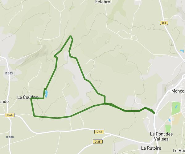
This running route covers 3.938mi starting from Loudéac, Côtes-d'Armor. The run is a loop trail and returns to the trailhead. This run is rated as easy, expect about 34m34s to complete it. The route has an elevation gain of 236ft and an elevation loss of 236ft.
Loudéac
Route details
6.84mph
Speed
395 kcal
Calories burned
Loop trail
Route type
390ft
Min altitude
538ft
Max altitude
Route profile
236ft
Elevation gain
236ft
Elevation loss
390ft
Min altitude
538ft
Max altitude
How to get there
Trailhead: Rue De La Chesnaie, 22600 Loudéac
GPS coordinates of the trailhead: 48.18208, -2.75325 / 48°10'55'' N, 2°45'11'' W