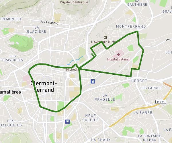
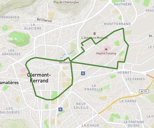
This running route covers 2.81mi starting from Aubière, Puy-de-Dôme. The run does not return to the trailhead and ends near 4 Parc De L'artière, 63122 Ceyrat, France. This run is rated as easy, expect about 27m to complete it. The route has an elevation gain of 453ft and an elevation loss of 79ft.
Cezeaux Artenium
Route details
6.24mph
Speed
309 kcal
Calories burned
Point to point
Route type
1348ft
Min altitude
1722ft
Max altitude
Route profile
453ft
Elevation gain
79ft
Elevation loss
1348ft
Min altitude
1722ft
Max altitude
How to get there
Trailhead: 67 Rue Pasteur, 63170 Aubière, France
GPS coordinates of the trailhead: 45.75767, 3.10621 / 45°45'27'' N, 3°6'22'' E