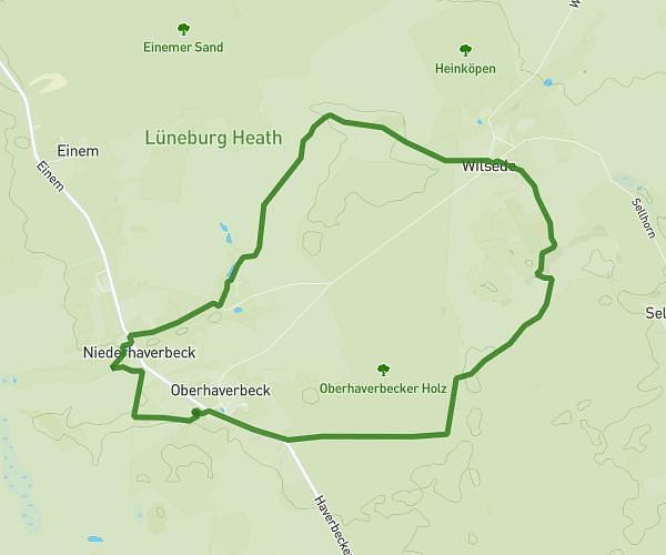
Explore this hiking route of 13.16km starting from Tostedt, Lower Saxony. The hike is a loop and returns to the starting point. This hike has no defined difficulty level, plan for about 3h17m to complete it. The route has a positive elevation gain of 185m and a negative elevation loss of 185m.
Brunsberg – Naturschutzgebiet Brunsberg Runde von Holm-Seppensen
Route details
Route profile
185m
Elevation +
185m
Elevation -
51m
Min altitude
119m
Max altitude
How to get there
Route starting point: Lohbergen, 21255 Tostedt
GPS coordinates of the starting point: 53.28586, 9.8254 / 53°17'9'' N, 9°49'31'' E
Calculate the time to reach the starting point from your location or an address