MapPlanner
5.955mi
Distance
1h4m
Duration
10:45/mi
Pace
Moderate
Level

Ali #1

Route details

5.58mph
Speed
732 kcal
Calories burned
Loop trail
Route type
344ft
Min altitude
364ft
Max altitude

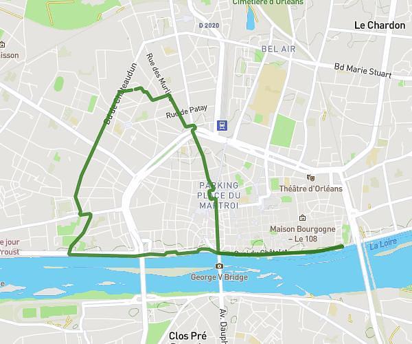
This running route covers 5.955mi starting from Orléans, Loiret. The run is a loop trail and returns to the trailhead. This run is rated as moderate, expect about 1h4m to complete it. The route has an elevation gain of 23ft and an elevation loss of 20ft.

Route profile

23ft
Elevation gain
20ft
Elevation loss
344ft
Min altitude
364ft
Max altitude

How to get there

Trailhead: 13 Rue Lugoj, 45100 Orléans, France

GPS coordinates of the trailhead: 47.83942, 1.92864 / 47°50'21'' N, 1°55'43'' E

Caution: May Cross Private Property

This route may pass through or near private property. Always respect posted signs, obtain permission where required, and follow local trespassing laws. MapPlanner does not guarantee public access along any route.

Safety Notice

Trail and road conditions may change without notice due to weather, construction, or other factors. Always verify current conditions before heading out. You are responsible for your own safety — follow local signage, obey traffic laws, and use your best judgment on the trail.