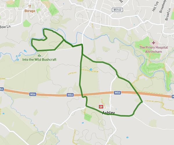
This walking route covers 2.297mi starting from Altrincham, England. The walk is a loop trail and returns to the trailhead. This walk is rated as easy, plan for about 49m to complete it. The route has an elevation gain of 112ft and an elevation loss of 112ft.
Ashley
Route details
21:19/mi
Pace
200 kcal
Calories burned
Loop trail
Route type
125ft
Min altitude
161ft
Max altitude
Route profile
112ft
Elevation gain
112ft
Elevation loss
125ft
Min altitude
161ft
Max altitude
How to get there
Trailhead: Ashley Road, Ashley, Altrincham, WA15 0QE, United Kingdom
GPS coordinates of the trailhead: 53.35449, -2.339763 / 53°21'16'' N, 2°20'23'' W