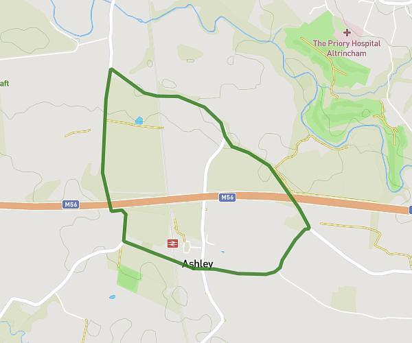
This walking route covers 4.058mi starting from Altrincham, England. The walk is a loop trail and returns to the trailhead. This walk is rated as moderate, plan for about 1h27m to complete it. The route has an elevation gain of 246ft and an elevation loss of 246ft.
Ashley long
Route details
21:27/mi
Pace
355 kcal
Calories burned
Loop trail
Route type
85ft
Min altitude
161ft
Max altitude
Route profile
246ft
Elevation gain
246ft
Elevation loss
85ft
Min altitude
161ft
Max altitude
How to get there
Trailhead: Ashley Road, Ashley, Altrincham, WA15 0QE, United Kingdom
GPS coordinates of the trailhead: 53.354482, -2.339563 / 53°21'16'' N, 2°20'22'' W