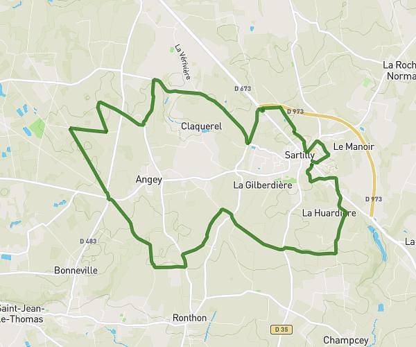
This running route covers 3.569mi starting from Bourguenolles, Manche. The run is a loop trail and returns to the trailhead. This run is rated as easy, expect about 24m to complete it. The route has an elevation gain of 285ft and an elevation loss of 285ft.
Dénivelé
Route details
8.92mph
Speed
274 kcal
Calories burned
Loop trail
Route type
433ft
Min altitude
607ft
Max altitude
Route profile
285ft
Elevation gain
285ft
Elevation loss
433ft
Min altitude
607ft
Max altitude
How to get there
Trailhead: D 81, 50870 Bourguenolles, France
GPS coordinates of the trailhead: 48.78824, -1.26788 / 48°47'17'' N, 1°16'4'' W