MapPlanner
5.62mi
Distance
3h33m
Duration
+810ft
Elevation gain
-810ft
Elevation loss
Moderate
Level

Oggy Roundz

Route details

1.58mph
Speed
1559 kcal
Calories burned
5.5%
Avg grade
Loop trail
Route type
23ft
Min altitude
308ft
Max altitude

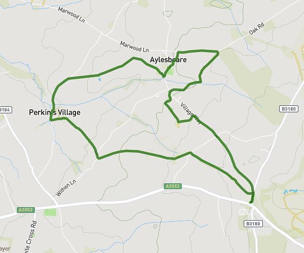
This hiking trail covers 5.62mi starting from Newton Abbot, England. The hike is a loop trail and returns to the trailhead. This hike is rated as moderate, plan for about 3h33m to complete it. The route has an elevation gain of 810ft and an elevation loss of 810ft.

Route profile

810ft
Elevation gain
810ft
Elevation loss
23ft
Min altitude
308ft
Max altitude

How to get there

Trailhead: Kingskerswell Road, TQ12 1DQ Newton Abbot

GPS coordinates of the trailhead: 50.51928, -3.59798 / 50°31'9'' N, 3°35'52'' W

Caution: May Cross Private Property

This route may pass through or near private property. Always respect posted signs, obtain permission where required, and follow local trespassing laws. MapPlanner does not guarantee public access along any route.

Safety Notice

Trail and road conditions may change without notice due to weather, construction, or other factors. Always verify current conditions before heading out. You are responsible for your own safety — follow local signage, obey traffic laws, and use your best judgment on the trail.