MapPlanner
4.281mi
Distance
51m40s
Duration
12:04/mi
Pace
Easy
Level

TAF MAISON

Route details

4.97mph
Speed
591 kcal
Calories burned
Point to point
Route type
7ft
Min altitude
85ft
Max altitude

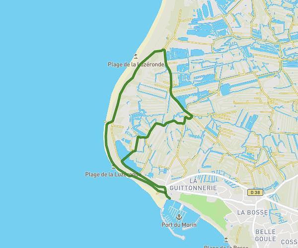
This running route covers 4.281mi starting from Saint-Michel-Chef-Chef, Loire-Atlantique. The run does not return to the trailhead and ends near 5 Allée Des Peupliers, 44250 Saint-Brevin-les-Pins, France. This run is rated as easy, expect about 51m40s to complete it. The route has an elevation gain of 292ft and an elevation loss of 292ft.

Description of the route by the creator

TRACK CD1

(Description automatically translated)

Route profile

292ft
Elevation gain
292ft
Elevation loss
7ft
Min altitude
85ft
Max altitude

How to get there

Trailhead: 3 Rue Des Tisserands, 44730 Saint-Michel-Chef-Chef, France

GPS coordinates of the trailhead: 47.1707, -2.149 / 47°10'14'' N, 2°8'56'' W

Caution: May Cross Private Property

This route may pass through or near private property. Always respect posted signs, obtain permission where required, and follow local trespassing laws. MapPlanner does not guarantee public access along any route.

Safety Notice

Trail and road conditions may change without notice due to weather, construction, or other factors. Always verify current conditions before heading out. You are responsible for your own safety — follow local signage, obey traffic laws, and use your best judgment on the trail.