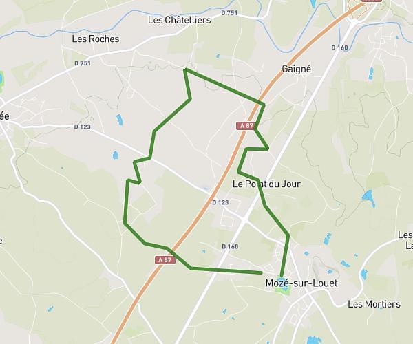
This running route covers 6.406mi starting from Les Garennes sur Loire, Maine-et-Loire. The run is a loop trail and returns to the trailhead. This run is rated as moderate, expect about 54m12s to complete it. The route has an elevation gain of 213ft and an elevation loss of 210ft.
trail 10km
Route details
7.09mph
Speed
620 kcal
Calories burned
Loop trail
Route type
66ft
Min altitude
164ft
Max altitude
Route profile
213ft
Elevation gain
210ft
Elevation loss
66ft
Min altitude
164ft
Max altitude
How to get there
Trailhead: 46 Route Du Plessis, 49610 Les Garennes sur Loire, France
GPS coordinates of the trailhead: 47.39855, -0.49013 / 47°23'54'' N, 0°29'24'' W