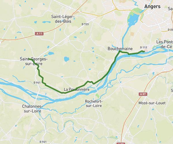
This running route covers 14.182mi starting from Saint-Georges-sur-Loire, Maine-et-Loire. The run does not return to the trailhead and ends near Chemin De La Garenne, 49130 Sainte-Gemmes-sur-Loire, France. This run is rated as strenuous, expect about 2h32m to complete it. The route has an elevation gain of 295ft and an elevation loss of 371ft.
maison-boulot
Route details
5.6mph
Speed
1738 kcal
Calories burned
Point to point
Route type
49ft
Min altitude
177ft
Max altitude
Route profile
295ft
Elevation gain
371ft
Elevation loss
49ft
Min altitude
177ft
Max altitude
How to get there
Trailhead: 3 Rue Maurice Lair, 49170 Saint-Georges-sur-Loire, France
GPS coordinates of the trailhead: 47.41108, -0.769653 / 47°24'39'' N, 0°46'10'' W